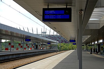
Directions to Warszawa Stadion station (Warsaw) with public transit
The following transit lines have routes that pass near Warszawa Stadion
How to get to Warszawa Stadion station by bus?
Click on the bus route to see step by step directions with maps, line arrival times and updated time schedules.
How to get to Warszawa Stadion station by train?
Click on the train route to see step by step directions with maps, line arrival times and updated time schedules.
How to get to Warszawa Stadion station by metro?
Click on the metro route to see step by step directions with maps, line arrival times and updated time schedules.
Bus stops near Warszawa Stadion stop in Warsaw
- Metro Stadion Narodowy 02, 3 min walk,
- Metro Stadion Narodowy 12, 7 min walk,
- Al. Zieleniecka 01, 7 min walk,
- Kijowska 01, 7 min walk,
- Most Świętokrzyski 02, 10 min walk,
Metro stations near Warszawa Stadion station in Warsaw
- Stadion Narodowy, 5 min walk,
Light Rail stations near Warszawa Stadion station in Warsaw
- Al. Zieleniecka 07, 6 min walk,
- Al. Zieleniecka 05, 7 min walk,
Bus lines to Warszawa Stadion station in Warsaw
- 102, Metro Stadion Narodowy - PKP Olszynka Grochowska,
- 125, Metro Stadion Narodowy - Międzylesie,
- 146, Dw. Wschodni (Lubelska) - Falenica,
- 147, Dw. Wschodni (Lubelska) - Stara Miłosna (Ułańska),
- 202, Metro Stadion Narodowy - PKP Gocławek,
- E-1, Metro Stadion Narodowy - Gocław,
- 135, PKP Olszynka Grochowska,
- 123, Dw. Wschodni (Lubelska),
- 138, Rondo Waszyngtona,
- 166, Kabaty-Stp,
- 509, Al. Zieleniecka,
- N02, Marysin,
- N03, Wiatraczna,
- N21, Płowiecka,
- N71, Dw. Centralny,
- 162, Dw. Wileński,
- N14, Olesin,
- N64, Kupiecka,
What are the closest stations to Warszawa Stadion?
The closest stations to Warszawa Stadion are:
- Metro Stadion Narodowy 02 is 166 meters away, 3 min walk.
- Stadion Narodowy is 321 meters away, 5 min walk.
- Al. Zieleniecka 07 is 430 meters away, 6 min walk.
- Metro Stadion Narodowy 12 is 476 meters away, 7 min walk.
- Al. Zieleniecka 01 is 477 meters away, 7 min walk.
- Al. Zieleniecka 05 is 495 meters away, 7 min walk.
- Kijowska 01 is 531 meters away, 7 min walk.
- Most Świętokrzyski 02 is 717 meters away, 10 min walk.
Which bus lines stop near Warszawa Stadion?
These bus lines stop near Warszawa Stadion: 138, 166, 509, 512.
Which train lines stop near Warszawa Stadion?
These train lines stop near Warszawa Stadion: R1, R2, S1.
Which metro line stops near Warszawa Stadion?
M2 (Bródno)
What’s the nearest light rail station to Warszawa Stadion in Warsaw?
The nearest light rail station to Warszawa Stadion in Warsaw is Al. Zieleniecka 07. It’s a 6 min walk away.
What’s the nearest metro station to Warszawa Stadion in Warsaw?
The nearest metro station to Warszawa Stadion in Warsaw is Stadion Narodowy. It’s a 5 min walk away.
What’s the nearest bus stop to Warszawa Stadion in Warsaw?
The nearest bus stop to Warszawa Stadion in Warsaw is Metro Stadion Narodowy 02. It’s a 3 min walk away.
What time is the first light rail to Warszawa Stadion in Warsaw?
The 7 is the first light rail that goes to Warszawa Stadion in Warsaw. It stops nearby at 4:11 AM.
What time is the last light rail to Warszawa Stadion in Warsaw?
The 9 is the last light rail that goes to Warszawa Stadion in Warsaw. It stops nearby at 12:49 AM.
What time is the first metro to Warszawa Stadion in Warsaw?
The M2 is the first metro that goes to Warszawa Stadion in Warsaw. It stops nearby at 5:14 AM.
What time is the last metro to Warszawa Stadion in Warsaw?
The M2 is the last metro that goes to Warszawa Stadion in Warsaw. It stops nearby at 12:28 AM.
What time is the first train to Warszawa Stadion in Warsaw?
The S1 is the first train that goes to Warszawa Stadion in Warsaw. It stops nearby at 3:58 AM.
What time is the last train to Warszawa Stadion in Warsaw?
The S2 is the last train that goes to Warszawa Stadion in Warsaw. It stops nearby at 12:24 AM.
What time is the first bus to Warszawa Stadion in Warsaw?
The N71 is the first bus that goes to Warszawa Stadion in Warsaw. It stops nearby at 3:03 AM.
What time is the last bus to Warszawa Stadion in Warsaw?
The N02 is the last bus that goes to Warszawa Stadion in Warsaw. It stops nearby at 3:45 AM.
See Warszawa Stadion station, Warsaw, on the map
Public Transit to Warszawa Stadion in Warsaw
Looking for directions to Warszawa Stadion in Warsaw, Poland?
Download the Moovit App to find the current schedule and step-by-step directions for Bus, Metro, Train or Light Rail routes that pass through Warszawa Stadion.
Looking for the nearest stops closest to Warszawa Stadion ? Check out this list of closest stops to your destination: Metro Stadion Narodowy 02; Stadion Narodowy; Al. Zieleniecka 07; Metro Stadion Narodowy 12; Al. Zieleniecka 01; Al. Zieleniecka 05; Kijowska 01; Most Świętokrzyski 02.
Bus: 138, 166, 509, 512, 102, 125, 146, 147, 202, 123, N02, 135, N03, N21, N71, 162, N14, N64.Train: R1, R2, S1.Metro: M2.
We make riding on public transit to Warszawa Stadion easy, which is why over 1.5 million users, including users in Warsaw trust Moovit as the best app for public transit.
Use the app to navigate to popular places including to the airport, hospital, stadium, grocery store, mall, coffee shop, school, college, and university.
Location: Warsaw
Bus stops near Warszawa Stadion stop
Metro station near Warszawa Stadion station
Get around Warsaw by public transit!
Traveling around Warsaw has never been so easy. See step by step directions as you travel to any attraction, street or major public transit station. View bus and train schedules, arrival times, service alerts and detailed routes on a map, so you know exactly how to get to anywhere in Warsaw.
When traveling to any destination around Warsaw use Moovit's Live Directions with Get Off Notifications to know exactly where and how far to walk, how long to wait for your line, and how many stops are left. Moovit will alert you when it's time to get off — no need to constantly re-check whether yours is the next stop.
Wondering how to use public transit in Warsaw or how to pay for public transit in Warsaw? Moovit public transit app can help you navigate your way with public transit easily, and at minimum cost. It includes public transit fees, ticket prices, and costs. Looking for a map of Warsaw public transit lines? Moovit public transit app shows all public transit maps in Warsaw with all Bus, Train, Metro, Light Rail, Ferry and Cable Car routes and stops on an interactive map.
Warsaw has 6 transit type(s), including: Bus, Train, Metro, Light Rail, Ferry and Cable Car, operated by several transit agencies, including Warszawski Transport Publiczny, Warszawska Kolej Dojazdowa, Koleje Mazowieckie, ZTP Kraków, Miasto Piastów, Miasto Ząbki, Koleje Małopolskie, Komunikacja Miejska Łomianki, Gmina Pruszków, MPK Wrocław, Gmina Mińsk Mazowiecki, MZDiK Radom, DKM Legionowo, DLA Miękinia and UM w Grodzisku Mazowieckim