Directions to Toruń Dworski station (Nowy Dwór Mazowiecki) with public transit
The following transit lines have routes that pass near Toruń Dworski
How to get to Toruń Dworski station by train?
Click on the train route to see step by step directions with maps, line arrival times and updated time schedules.
Train stations near Toruń Dworski in Nowy Dwór Mazowiecki
- Brody Warszawskie, 11 min walk,
- Pomiechówek, 71 min walk,
What are the closest stations to Toruń Dworski?
The closest stations to Toruń Dworski are:
- Brody Warszawskie is 815 meters away, 11 min walk.
- Pomiechówek is 5566 meters away, 71 min walk.
Which train line stops near Toruń Dworski?
R90
What’s the nearest train station to Toruń Dworski in Nowy Dwór Mazowiecki?
The nearest train station to Toruń Dworski in Nowy Dwór Mazowiecki is Brody Warszawskie. It’s a 11 min walk away.
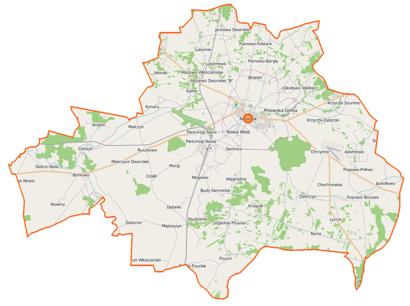
See Toruń Dworski, Nowy Dwór Mazowiecki, on the map
Public Transit to Toruń Dworski in Nowy Dwór Mazowiecki
Wondering how to get to Toruń Dworski in Nowy Dwór Mazowiecki, Poland? Moovit helps you find the best way to get to Toruń Dworski with step-by-step directions from the nearest public transit station.
Moovit provides free maps and live directions to help you navigate through your city. View schedules, routes, timetables, and find out how long does it take to get to Toruń Dworski in real time.
Looking for the nearest stop or station to Toruń Dworski? Check out this list of stops closest to your destination: Brody Warszawskie; Pomiechówek.
Train: R90, R9, R80, RE9, RE80, RE90, RE91, RE92.
Want to see if there’s another route that gets you there at an earlier time? Moovit helps you find alternative routes or times. Get directions from and directions to Toruń Dworski easily from the Moovit App or Website.
We make riding to Toruń Dworski easy, which is why over 1.5 million users, including users in Nowy Dwór Mazowiecki, trust Moovit as the best app for public transit. You don’t need to download an individual bus app or train app, Moovit is your all-in-one transit app that helps you find the best bus time or train time available.
For information on prices of train, bus and light rail, costs and ride fares to Toruń Dworski, please check the Moovit app.
Use the app to navigate to popular places including to the airport, hospital, stadium, grocery store, mall, coffee shop, school, college, and university.
Location: Nowy Dwór Mazowiecki, Warsaw
Places Near Toruń Dworski (Nowy Dwór Mazowiecki)
How to get to popular places in Warsaw with public transit
Get around Nowy Dwór Mazowiecki by public transit!
Traveling around Nowy Dwór Mazowiecki has never been so easy. See step by step directions as you travel to any attraction, street or major public transit station. View bus and train schedules, arrival times, service alerts and detailed routes on a map, so you know exactly how to get to anywhere in Nowy Dwór Mazowiecki.
When traveling to any destination around Nowy Dwór Mazowiecki use Moovit's Live Directions with Get Off Notifications to know exactly where and how far to walk, how long to wait for your line, and how many stops are left. Moovit will alert you when it's time to get off — no need to constantly re-check whether yours is the next stop.
Wondering how to use public transit in Nowy Dwór Mazowiecki or how to pay for public transit in Nowy Dwór Mazowiecki? Moovit public transit app can help you navigate your way with public transit easily, and at minimum cost. It includes public transit fees, ticket prices, and costs. Looking for a map of Nowy Dwór Mazowiecki public transit lines? Moovit public transit app shows all public transit maps in Nowy Dwór Mazowiecki with all Bus, Train, Metro, Light Rail, Ferry and Cable Car routes and stops on an interactive map.
Warsaw has 6 transit type(s), including: Bus, Train, Metro, Light Rail, Ferry and Cable Car, operated by several transit agencies, including Warszawski Transport Publiczny, Miasto Ząbki, Gmina Pruszków, Warszawska Kolej Dojazdowa, Koleje Mazowieckie, Komunikacja Miejska Łomianki, Miasto Piastów, MZDiK Radom, UM w Grodzisku Mazowieckim, UM w Nowym Dworze Mazowieckim, Grodziskie Przewozy Autobusowe, UM Płońsk, PKS Nova Białystok, PT Necko - Augustów and ZEC Sp. z o.o.