Directions to Mariensztat station (Warsaw) with public transit
The following transit lines have routes that pass near Mariensztat
How to get to Mariensztat station by bus?
Click on the bus route to see step by step directions with maps, line arrival times and updated time schedules.
How to get to Mariensztat station by train?
Click on the train route to see step by step directions with maps, line arrival times and updated time schedules.
How to get to Mariensztat station by metro?
Click on the metro route to see step by step directions with maps, line arrival times and updated time schedules.
Light Rail stations near Mariensztat in Warsaw
- Stare Miasto, 3 min walk,
- Pl. Bankowy, 17 min walk,
Bus stops near Mariensztat in Warsaw
- Mariensztat, 4 min walk,
- Stare Miasto, 4 min walk,
- Nowy Zjazd, 5 min walk,
- Pl. Zamkowy, 5 min walk,
- Browarna, 7 min walk,
- Kapitulna, 7 min walk,
- Pl. Piłsudskiego, 9 min walk,
Bus lines to Mariensztat station in Warsaw
- 106, Ostroroga,
- 118, Spartańska,
- N16, Dw. Centralny,
- 185, Gwiaździsta,
- 116, Chomiczówka - Wilanów,
- 178, Skorosze - Konwiktorska,
- 180, Wilanów - Chomiczówka,
- 503, Natolin Płn. - Konwiktorska,
- E-2, Wilanów - Metro Ratusz Arsenał,
- N44, Zajezdnia Żoliborz - Dw. Centralny,
- 128, Szczęśliwice,
- 175, Pl. Piłsudskiego,
- 127, Dw. Centralny,
- 518, Bielańska,
- 111, Esperanto,
What are the closest stations to Mariensztat?
The closest stations to Mariensztat are:
- Stare Miasto is 197 meters away, 3 min walk.
- Mariensztat is 218 meters away, 4 min walk.
- Nowy Zjazd is 346 meters away, 5 min walk.
- Pl. Zamkowy is 359 meters away, 5 min walk.
- Browarna is 457 meters away, 7 min walk.
- Kapitulna is 486 meters away, 7 min walk.
- Pl. Piłsudskiego is 644 meters away, 9 min walk.
- Pl. Bankowy is 1267 meters away, 17 min walk.
Which bus lines stop near Mariensztat?
These bus lines stop near Mariensztat: 111, 116, 127, 128, 175, 178, 185, 190, 503.
Which train lines stop near Mariensztat?
These train lines stop near Mariensztat: R7, S2, S4.
Which metro lines stop near Mariensztat?
These metro lines stop near Mariensztat: M1, M2.
Which light rail lines stop near Mariensztat?
These light rail lines stop near Mariensztat: 23, 26.
What’s the nearest light rail station to Mariensztat in Warsaw?
The nearest light rail station to Mariensztat in Warsaw is Stare Miasto. It’s a 3 min walk away.
What’s the nearest bus station to Mariensztat in Warsaw?
The nearest bus stations to Mariensztat in Warsaw are Mariensztat and Stare Miasto. The closest one is a 4 min walk away.
What time is the first light rail to Mariensztat in Warsaw?
The 23 is the first light rail that goes to Mariensztat in Warsaw. It stops nearby at 4:39 AM.
What time is the last light rail to Mariensztat in Warsaw?
The 16 is the last light rail that goes to Mariensztat in Warsaw. It stops nearby at 11:40 PM.
What time is the first bus to Mariensztat in Warsaw?
The N44 is the first bus that goes to Mariensztat in Warsaw. It stops nearby at 3:19 AM.
What time is the last bus to Mariensztat in Warsaw?
The N21 is the last bus that goes to Mariensztat in Warsaw. It stops nearby at 3:23 AM.
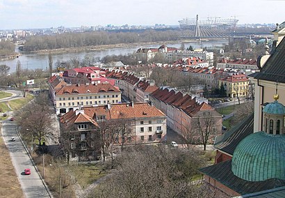
See Mariensztat, Warsaw, on the map
Public Transit to Mariensztat in Warsaw
How to get to Mariensztat in Warsaw, Poland?
It’s easy with Moovit. Type in your street address and Moovit’s route finder will locate the fastest way to get you there! Not sure where to get off on the street? Download the Moovit App to find live directions (including where to get off on Mariensztat), see timetables and get the estimated arrival times for your favorite bus, light rail, metro or train lines.
Looking for the nearest stop or station to Mariensztat? Check out this list of closest stops available to your destination: Stare Miasto; Mariensztat; Nowy Zjazd; Pl. Zamkowy; Browarna; Kapitulna; Pl. Piłsudskiego; Pl. Bankowy.
Bus: 111, 116, 127, 128, 175, 178, 185, 190, 503, 106, 118, N16, 180, E-2.Train: R7, S2, S4.Metro: M1, M2.Light Rail: 23, 26.
Download the Moovit App to see the current schedule and routes available for Warsaw. No need to install a special bus app to check the bus time or a train app to get train time. Moovit is the only all-in-one transit app that helps you get where you need to go.
We make riding on public transit to Mariensztat easy, which is why over 1.5 million users, including users in Warsaw trust Moovit as the best app for public transit.
Use the app to navigate to popular places including to the airport, hospital, stadium, grocery store, mall, coffee shop, school, college, and university.
Location: Warsaw
Streets near Mariensztat, Warsaw
Get around Warsaw by public transit!
Traveling around Warsaw has never been so easy. See step by step directions as you travel to any attraction, street or major public transit station. View bus and train schedules, arrival times, service alerts and detailed routes on a map, so you know exactly how to get to anywhere in Warsaw.
When traveling to any destination around Warsaw use Moovit's Live Directions with Get Off Notifications to know exactly where and how far to walk, how long to wait for your line, and how many stops are left. Moovit will alert you when it's time to get off — no need to constantly re-check whether yours is the next stop.
Wondering how to use public transit in Warsaw or how to pay for public transit in Warsaw? Moovit public transit app can help you navigate your way with public transit easily, and at minimum cost. It includes public transit fees, ticket prices, and costs. Looking for a map of Warsaw public transit lines? Moovit public transit app shows all public transit maps in Warsaw with all Bus, Train, Metro, Light Rail, Ferry and Cable Car routes and stops on an interactive map.
Warsaw has 6 transit type(s), including: Bus, Train, Metro, Light Rail, Ferry and Cable Car, operated by several transit agencies, including Warszawski Transport Publiczny, Miasto Ząbki, Gmina Pruszków, Warszawska Kolej Dojazdowa, Koleje Mazowieckie, Komunikacja Miejska Łomianki, Miasto Piastów, MZDiK Radom, UM w Grodzisku Mazowieckim, UM w Nowym Dworze Mazowieckim, Grodziskie Przewozy Autobusowe, UM Płońsk, PKS Nova Białystok, PT Necko - Augustów and ZEC Sp. z o.o.