Grudów stop - Thursday schedule
| Line | Direction | Time |
|---|---|---|
| B1 | Brwinów Rynek | 06:25 |
| B1 | Brwinów Rynek | 07:28 |
| B3 | Brwinów Rynek | 09:43 |
| B1 | Brwinów Rynek | 12:21 |
| B3 | Brwinów Rynek | 12:46 |
| B1 | Brwinów Rynek | 18:03 |
| B3 | Brwinów Rynek | 18:36 |
| B1 | Brwinów Rynek | 19:13 |
Directions to Grudów (Pruszków) with public transportation
The following transit lines have routes that pass near Grudów
How to get to Grudów by bus?
Click on the bus route to see step by step directions with maps, line arrival times and updated time schedules.
How to get to Grudów by train?
Click on the train route to see step by step directions with maps, line arrival times and updated time schedules.
Bus stops near Grudów in Pruszków
- Grudów, 2 min walk,
Train stations near Grudów in Pruszków
- Milanówek Grudów, 11 min walk,
- Milanówek, 20 min walk,
Bus lines to Grudów in Pruszków
- B3, Błonie PKP,
What are the closest stations to Grudów?
The closest stations to Grudów are:
- Grudów is 75 meters away, 2 min walk.
- Milanówek Grudów is 849 meters away, 11 min walk.
- Milanówek is 1522 meters away, 20 min walk.
Which bus lines stop near Grudów?
These bus lines stop near Grudów: 17, B1, B5.
Which train lines stop near Grudów?
These train lines stop near Grudów: A12, R1.
What’s the nearest train station to Grudów in Pruszków?
The nearest train station to Grudów in Pruszków is Milanówek Grudów. It’s a 11 min walk away.
What’s the nearest bus stop to Grudów in Pruszków?
The nearest bus stop to Grudów in Pruszków is Grudów. It’s a 2 min walk away.
What time is the first train to Grudów in Pruszków?
The R1 is the first train that goes to Grudów in Pruszków. It stops nearby at 4:02 AM.
What time is the last train to Grudów in Pruszków?
The A1 is the last train that goes to Grudów in Pruszków. It stops nearby at 1:24 AM.
How much is the bus fare to Grudów?
The bus fare to Grudów costs about zł3.40.
How much is the train fare to Grudów?
The train fare to Grudów costs about zł4.10.
See Grudów, Pruszków, on the map
Public transit to Grudów stop in Pruszków
Looking for directions to Grudów in Pruszków, Poland?
Download the Moovit App to find the current schedule and step-by-step directions for Bus or Train routes that pass through Grudów.
Looking for the nearest stops closest to Grudów ? Check out this list of closest stops to your destination: Grudów; Milanówek Grudów; Milanówek.
Bus: 17, B1, B5, B3.Train: A12, R1, WDK, RE1, R2, R6, R7.
We make riding on public transit to Grudów easy, which is why over 1.5 million users, including users in Pruszków trust Moovit as the best app for public transit.
Use the app to navigate to popular places including to the airport, hospital, stadium, grocery store, mall, coffee shop, school, college, and university.
The first line to this stop is B1, at 06:25, and the last line is B1 at 19:13.
This stop serves PKS Grodzisk Mazowiecki’s lines
Grudów [ˈɡruduf] is a village in the administrative district of Gmina Brwinów, within Pruszków County, Masovian Voivodeship, in east-central Poland.Wiki
Popular routes from Grudów, Pruszków
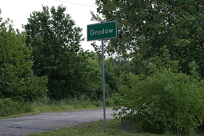
Bus stop near Grudów
GrudówPopular public transit stations in Pruszków
Legionowo Mickiewicza 01,Słowackiego / Średnia,Pruszków / Urząd Skarbowy 01,Teligi 02,Nowy Dwór Maz. Morawicza 01,Lazurowa 03,Dw. Zachodni 01,Sielce 02,Paderewskiego / Sempołowskiej,Borowiecka 02,Chrzanów 01,Stary Sękocin 02,Stawki 02,Kabaty,Centrum 15,Magiera 01,Marki Szpitalna 02,Płowiecka 02,Hala Sportowa Bemowo 01,Legionowo Centrum Komunikacyjne 01Get around Warsaw by public transit!
Traveling around Warsaw has never been so easy. See step by step directions as you travel to any attraction, street or major public transit station. View bus and train schedules, arrival times, service alerts and detailed routes on a map, so you know exactly how to get to anywhere in Warsaw.
When traveling to any destination around Warsaw use Moovit's Live Directions with Get Off Notifications to know exactly where and how far to walk, how long to wait for your line, and how many stops are left. Moovit will alert you when it's time to get off — no need to constantly re-check whether yours is the next stop.
Wondering how to use public transit in Warsaw or how to pay for public transit in Warsaw? Moovit public transit app can help you navigate your way with public transit easily, and at minimum cost. It includes public transit fees, ticket prices, and costs. Looking for a map of Warsaw public transit lines? Moovit public transit app shows all public transit maps in Warsaw with all Bus, Train, Metro, Light Rail, Ferry and Cable Car routes and stops on an interactive map.
Warsaw has 6 transit type(s), including: Bus, Train, Metro, Light Rail, Ferry and Cable Car, operated by several transit agencies, including Warszawski Transport Publiczny, Warszawska Kolej Dojazdowa, Koleje Mazowieckie, ZTP Kraków, Miasto Piastów, Miasto Ząbki, Koleje Małopolskie, Komunikacja Miejska Łomianki, Gmina Pruszków, MPK Wrocław, Gmina Mińsk Mazowiecki, MZDiK Radom, DKM Legionowo, DLA Miękinia, PKS Grodzisk Mazowiecki